
Atmospheric pressure, isobars, cyclones, and anticyclones. Sounds like complicated stuff, right? Well, it’s actually a lot less complicated than it seems.
Over the next few minutes, we are going to explore these and other weather-related topics that will help you understand how our atmosphere works.
Let’s get started!
Air Pressure
So, first off, what is air pressure? You’ve probably learned that pressure results from force being applied to an object. The air above our heads is constantly applying a force on us and our atmosphere. On average, air pressure is about 14 pounds per square inch at sea level. If you’re an average adult human, meaning you’re about 2,500 square inches, that comes out to almost 16 tons of pressure being forced on you at any given moment in time. So why aren’t we just crushed by all that pressure? Well, that’s because the pressure inside our bodies is the same as it is outside our bodies. Since there is no difference in pressure, we stay intact. Thank goodness.
Now, when we’re talking about weather, air pressure is not measured in pounds per square inch or PSI. Those numbers would get out of control quickly. Meteorologists and most professionals measure air pressure in millibars (mb). The average air pressure at sea level, measured in millibars, is about 1,013 millibars.
Check out this map of the United States. This is a color-coded map that shows average air pressures, with the 1,013 mb average being in the dark orange/red range. You’ll notice that there are areas of lower and higher pressure throughout the United States (and throughout the whole world), which is why we use an average sea-level value.
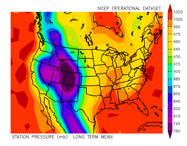
What may immediately jump out at you here is that there is a band of lower pressures which coincide with the Rocky Mountain range. Hopefully, this will jog your memory that air pressure decreases with altitude. This is why you might hear that the air is “thin” at the peak of Mount Everest; there’s less air pressure there, which means less air pressing down on you!
This is a good time to talk about what happens when there is a difference in air pressure. Let’s say the air pressure is 1023 mb on the west side of a city and 1000 on the east side of the city – air will flow from the area of higher pressure to an area of lower pressure. In this case, the air will flow from west to east (as it does most of the time).
As I’m sure you might have guessed, this flow of air is what we know as wind.
Isobars
So, before we get any further, we need to talk about isobars, which you might have seen before if you’ve ever watched the Weather Channel. Isobars are just lines that show areas of equal pressure. That’s it!
Take a look at this map of the US. All of the maroon lines that you see are isobars. They represent areas of equal pressure, and they are labeled in millibars.
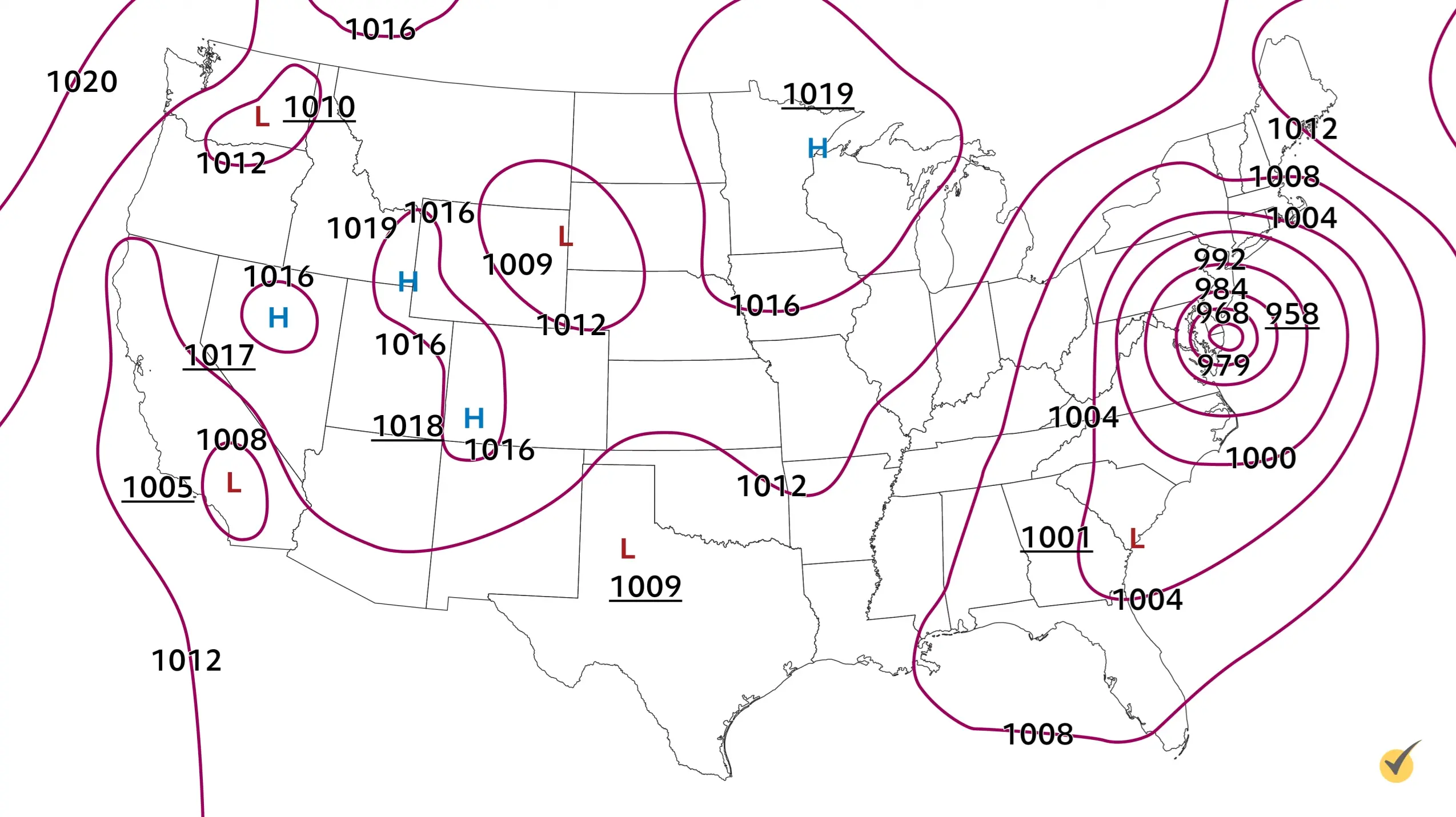
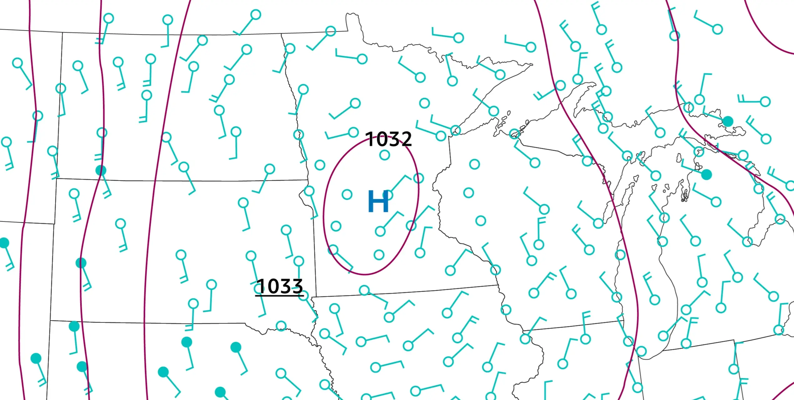
Check out the closed isobar located in Nevada.
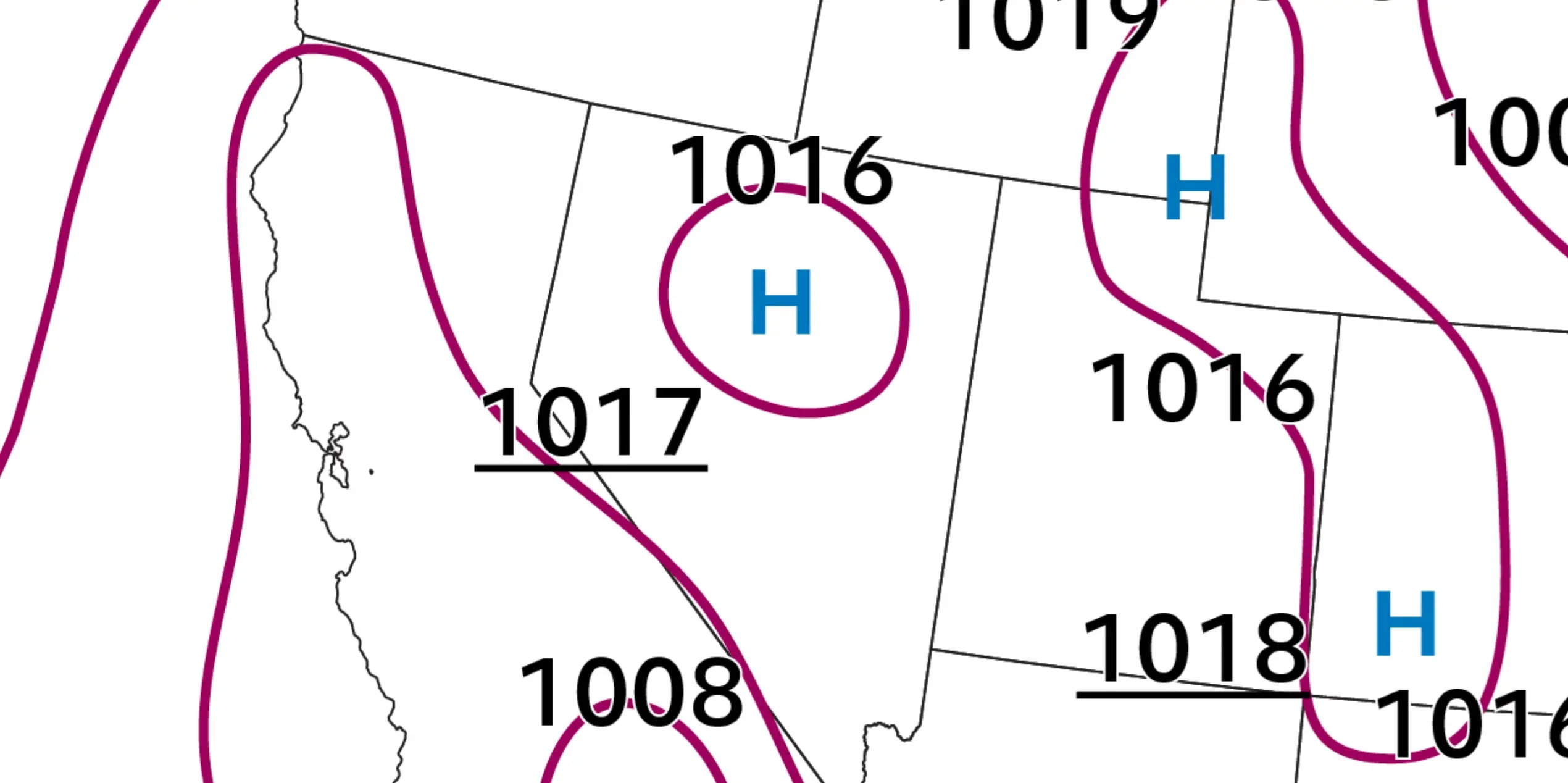
Every point that lies on this isobar has the same pressure, 1016 mb, which is a little higher than average. You’ll notice, then, that there is an “H” enclosed in this isobar, indicating high pressure.
Look at this crazy swirl of isobars off the eastern coast of the United States. There are many isobars over here and they are each labeled.
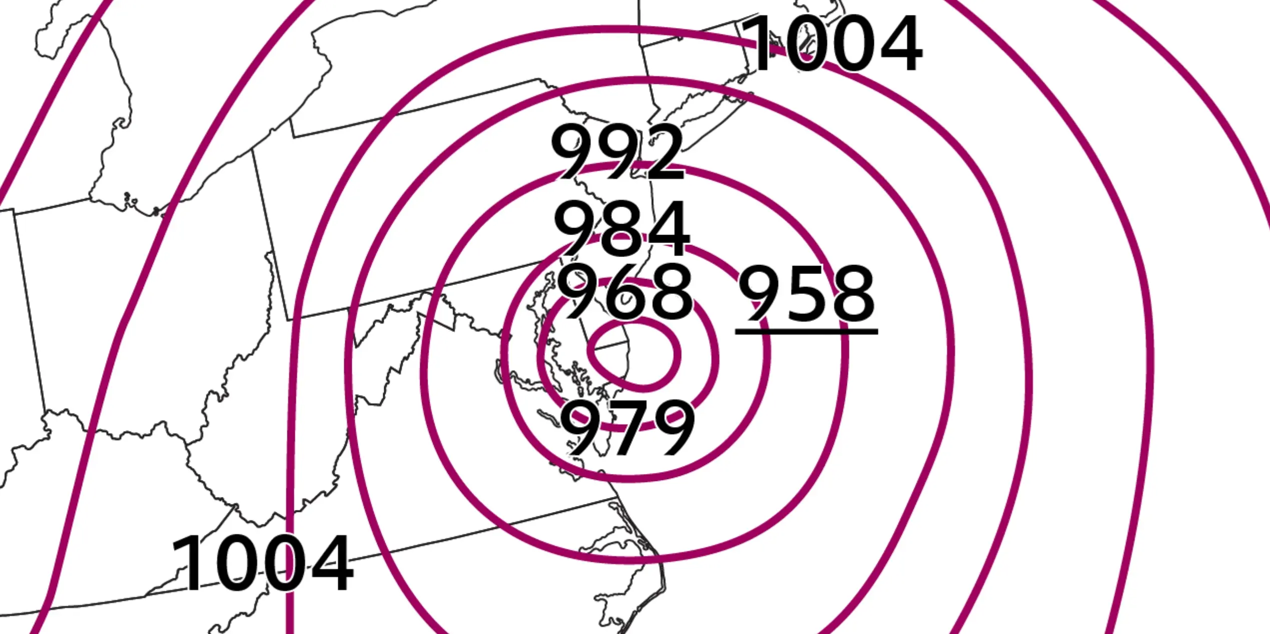
What we can see is that isobars representing the lowest pressures are in the center, and each outward radiating isobar represents a higher pressure. 958 mb high pressure, which is underlined, was the central pressure at the time this map was created. This isobar map is actually showing Hurricane Irene, a 2011 hurricane that caused a great deal of damage in the eastern states.
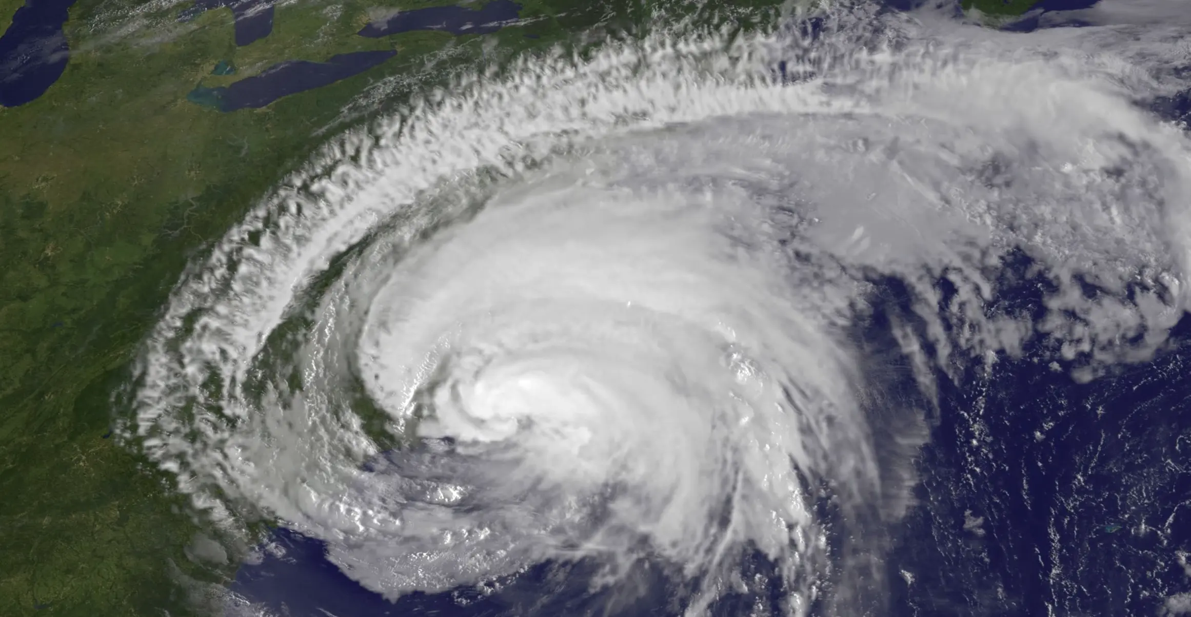
Here’s a satellite image from roughly the same time as the isobar map, to provide some context.
Now that we’ve talked about isobars, I’d like to jump back to pressure gradients, which are going to be a lot easier to understand now that you’ve got the basics.
Focus on the western side of this low-pressure system. See how the isobars are tightly packed here?
This represents a large pressure gradient. This large pressure gradient means that the air over there at a higher pressure wants to get to an area of lower pressure, and it will do so at a faster rate since the isobars are tightly packed. This will result in a stronger wind.
Now, check out the isobars way to the east of the low-pressure system. They are pretty spaced apart, representing a weak pressure gradient. There may still be wind here, but there’s not so much of a rush for air to get from higher to lower pressure, so the wind will be weak, just like the gradient!
Okay, now that we know about isobars, gradients, and how air moves across gradients, we can talk some more about high-pressure systems, low-pressure systems, and their rotations!
There are a lot of in-depth processes that control exactly how wind moves around isobars, but we’re going to keep it fairly simple here.
What we’re going to focus on in this picture are the wind barbs—the green dots with a stick on the end that you see all over the map.
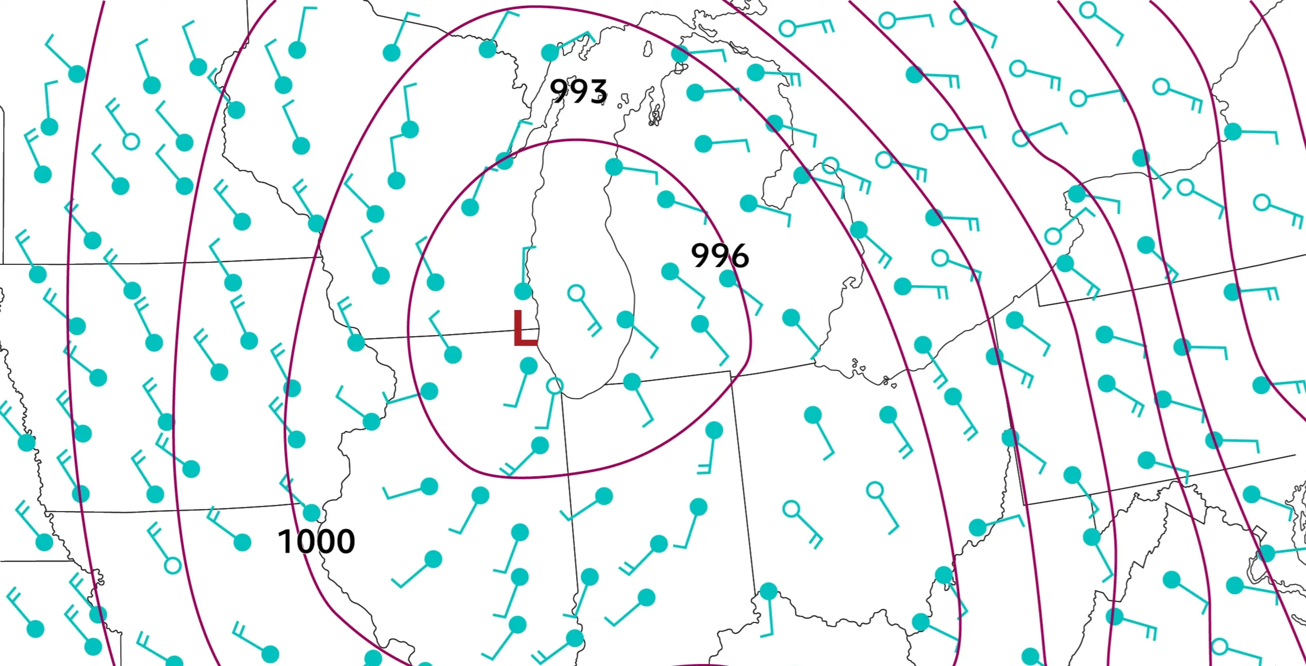
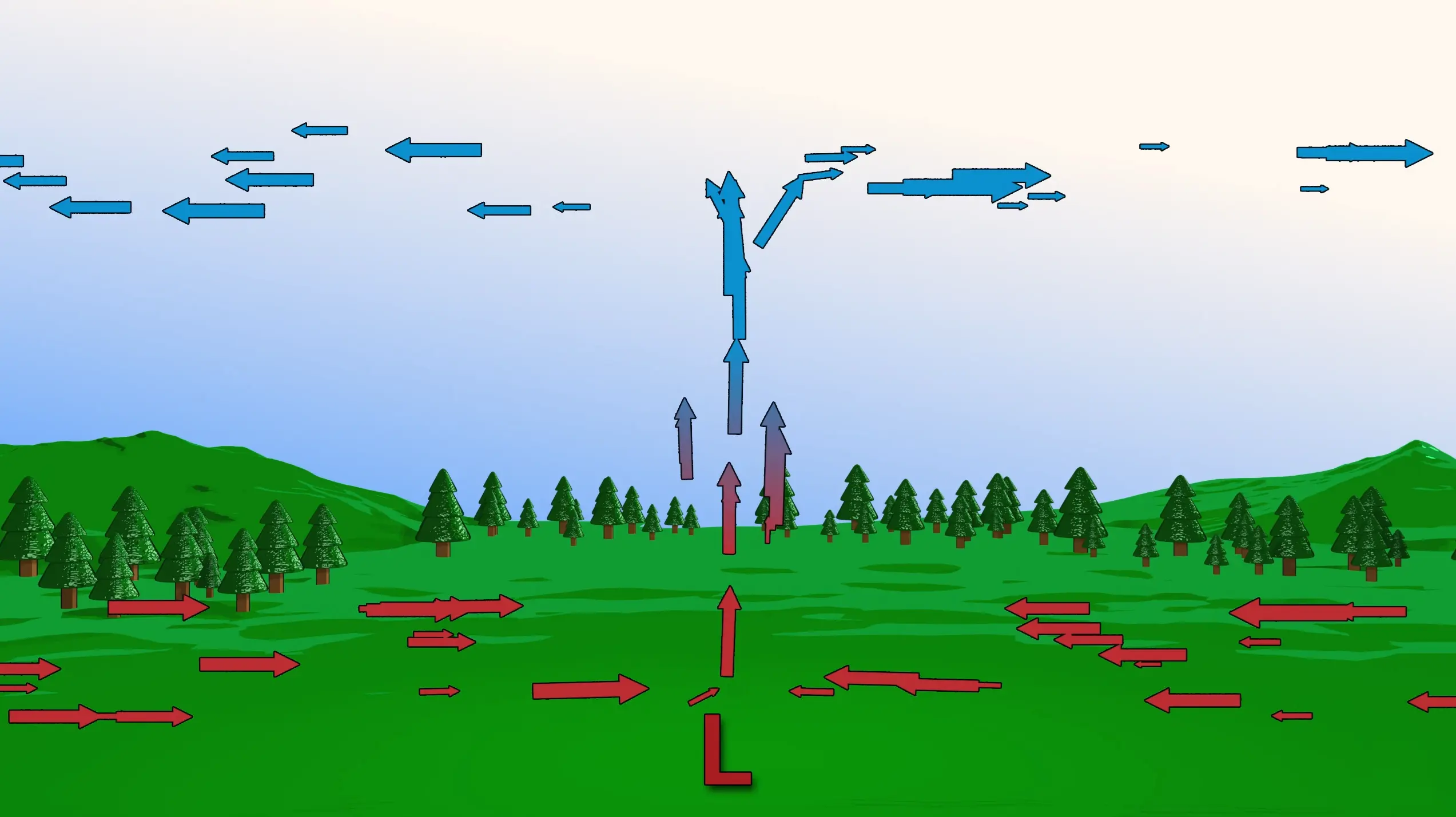
In a nutshell, these symbols tell you (along with a bunch of other things) which direction the wind is flowing from. While you’re looking at this map, I want you to notice the “stick” end of these green figures. As far as wind, think of the stick as the starting point, and the dot as the ending point. Think of it like wind is flowing from the stick to the dot. If you look at this picture as a whole, and all those dots and sticks as a whole, you’ll see that air is flowing counterclockwise toward the center of the low-pressure system. In the Northern Hemisphere, these systems are called cyclones.
Low and High Pressure Systems
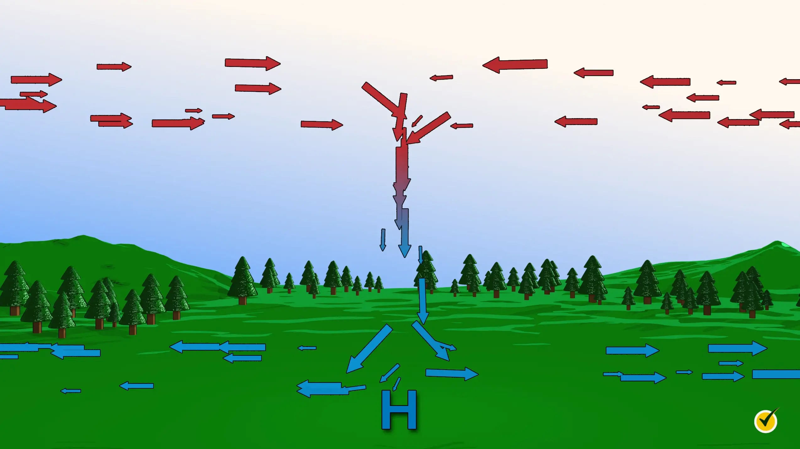
Next, let’s look at this high-pressure system and see if you can determine which direction the winds are blowing from.
Hopefully, you were able to tell that air is flowing clockwise away from the center of the high-pressure system. In the Northern Hemisphere, high-pressure systems are called anticyclones.
All right, so now we know all about air pressure, what drives wind, and how cyclones and anticyclones work. One last bit to talk about, here: What kind of weather do these systems of pressure cause?
We talked a little earlier about Hurricane Irene being a strong low-pressure system, so let’s talk about why low-pressure systems typically bring “bad” weather.
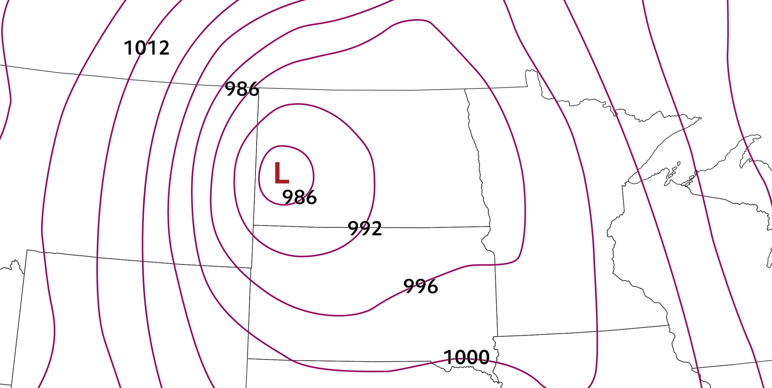
The red “L” at the surface here lets us know that this is a low-pressure system. To help understand this concept a little bit better, imagine a dollop of whipped cream sitting on a table. If you take two books on either side of the whipped cream and smash them together, the whipped cream will squirt upward.
As air rises, it will eventually condensate and form clouds. In the case of hurricanes, these are just low-pressure systems that have had plenty of time to develop a sustained low. In our continental example of the United States, a low-pressure system likely means we’ll see some clouds or rain, or maybe even a thunderstorm.
Now, let’s look at a high-pressure system.
The H near the surface is what tells us this is a high-pressure system. Let’s go back to the whipped cream example. Imagine that same dollop of whipped cream is sitting on the table. Now drop a book on it from above. What happens to the whipped cream? It’s going to squirt out horizontally from either side. The same concept applies here with high-pressure systems!
The only way we get clouds in the sky (and subsequently “bad” weather) is with rising air reaching the condensation level. Since there’s no rising air in a high-pressure system, there are no clouds! You’ll always hear weather forecasters relating nice weather with high-pressure systems, and now you know why!
Review Questions
That was a lot of information. Let’s see what you remember.
1. In which direction does air generally flow?
- From west to east.
- From high-pressure to low-pressure.
- From low-pressure to high-pressure.
- Clockwise in the northern hemisphere.
Nearly everything in science wants to be at equilibrium, and the only way that happens with wind is by flowing from a higher gradient to a lower gradient.
2. What is another name for a low-pressure system?
- Hurricane
- Tornado
- Anticyclone
- Cyclone
A tornado is a very specific type of a low-pressure phenomenon, but not every low-pressure system will produce a tornado. In fact, most don’t.
I hope this review was helpful! Thanks for watching, and happy studying!