

Hi, and welcome to this video on regional geography!
Put simply, regional geography is a branch of geography that studies the world’s regions. A region itself is defined as a part of the Earth’s surface with one or many similar characteristics that make it unique from other areas. Today, we’re going to look at various types of regional geography found throughout the world.
North and South America
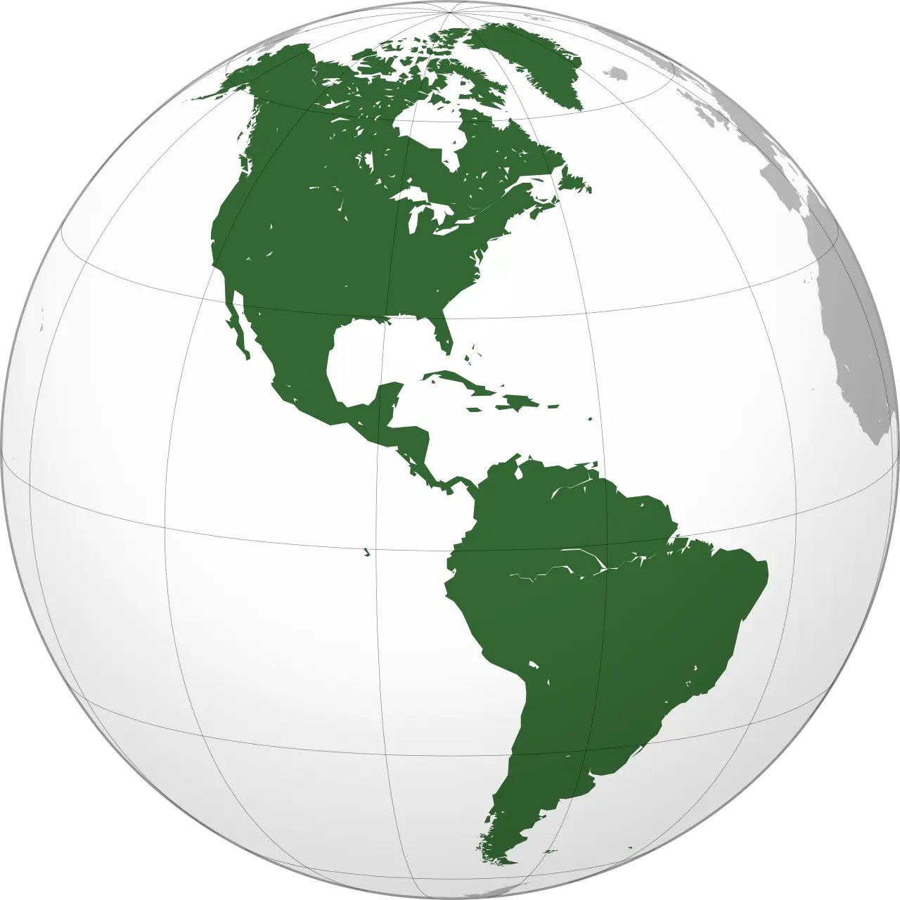
Let’s start with North America. Located between the Atlantic and Pacific Oceans in the northern part of the western hemisphere, North America is home to roughly 579 million people. The continent is full of a large variety of natural resources, including great mineral wealth, vast forests, immense quantities of fresh water, and some of the world’s most fertile soils.
Being the third largest continent, it spans almost every known climate zone from hot equatorial in the southern tip of Central America to the frozen tundra of northern Canada. To simplify things, North America can be physically divided into five regions: the mountainous west, the Great Plains, the Canadian Shield, the varied eastern region, and the Caribbean.
The west consists mainly of three “young” mountain chains (the Cascades, the Rocky Mountains, and the Sierra Madre Mountains) and three deserts formed by rain shadows (the Mojave, the Sonoran, and the Chihuahuan). The Great Plains consists of a massive grassland prairie forming much of the interior of the continent, with fertile soils producing food that feeds much of the world. The world’s largest and most destructive tornadoes are also found here.
The Canadian Shield is a plateau extending over eastern and northwestern Canada, characterized by numerous lakes and a permafrost due to its tundra climate. The varied Eastern Region consists of the Atlantic coastal plain along the eastern coast and the resource-rich Appalachian Mountains just inland from the Atlantic Ocean.
Within the Atlantic coastal plain lies large riparian and wetland biomes, most notable of which are the Florida Everglades. The Caribbean Region includes more than 7,000 islands, islets, reefs, and cays within the Caribbean Sea between North and South America.
Moving south, let’s look at South America. The South American continent lies in the western hemisphere and is divided politically into 12 independent countries. Together, these countries have a combined population of more than 420 million.
Due to climate here ranging from equatorial to tundra and everything in between, South America can be divided into four main landforms: mountains, highlands, river basins, and coastal plains. Mountains and coastal plains generally run in a north-south direction, while highlands and river basins generally run in an east-west direction, with extreme geographic variation contributing to the continent’s large number of biomes.
Beginning in the north and containing the tallest peaks outside of Asia, the Andes are the longest mountain chain in the world reaching 4,349 miles down the Western length of South America. Next is the Amazon River, known as the second longest river in the world after the Nile River. Flowing through the Amazon Rainforest across the width of the complex Amazon River Basin watershed, this river drains the Amazon Rainforest, which covers much of the interior of Brazil, parts of the Andes, and reaches into the Brazilian Highlands.
At an average elevation of 3,280 feet above sea level, the Brazilian Highlands cover about 1.9 million square miles in eastern, central, and southern Brazil, with the incredibly arid Atacama Desert located in the Chilean Andes at the southwestern part of the continent. To note, coastal plains can be found along most of the continent across several of the climate zones.
Europe
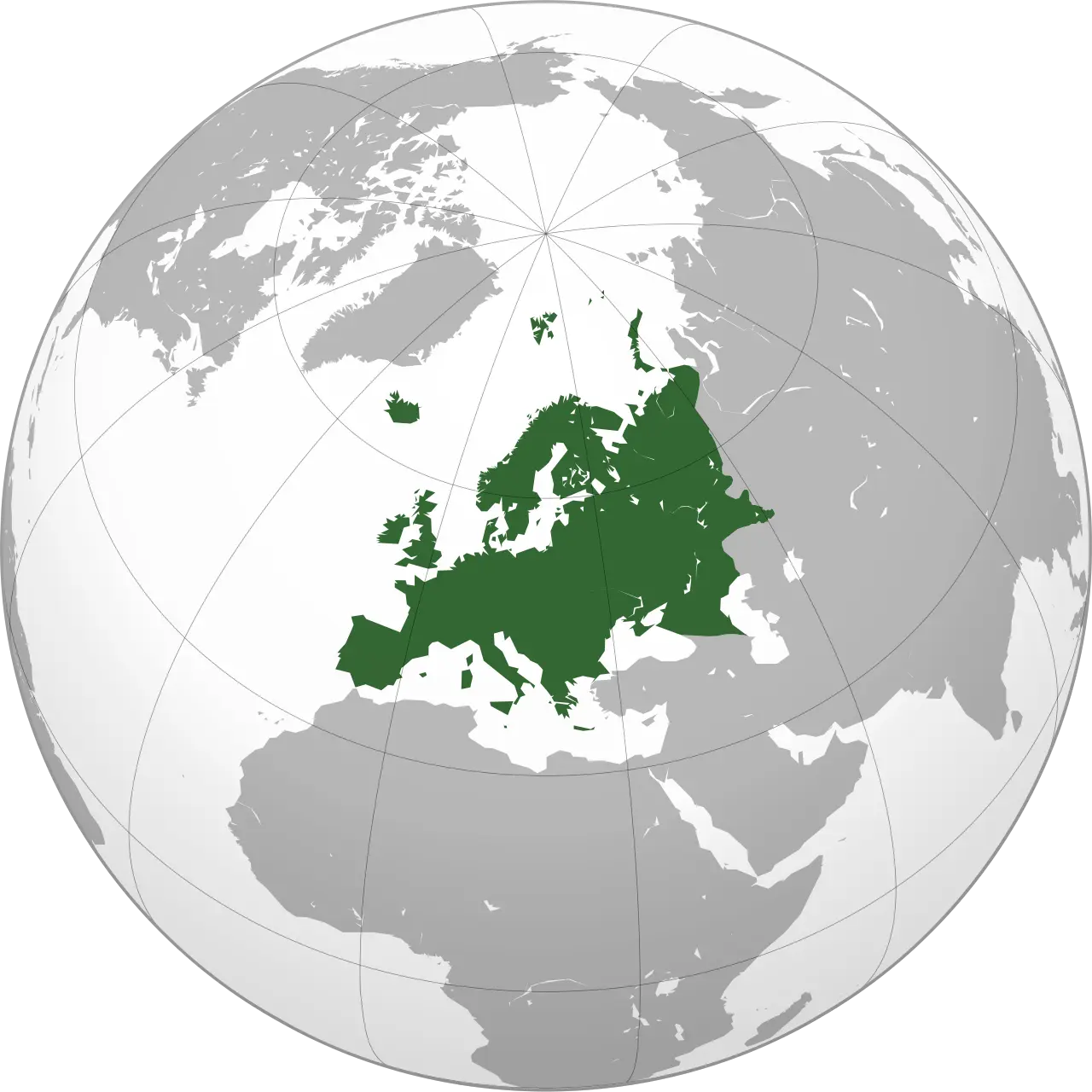
Let’s move a bit northeast and look at Europe. Positioned south of the Arctic Ocean, east of the Atlantic Ocean, and north of the Mediterranean Sea, Europe receives a multitude of climates from Mediterranean to Taiga across its length. Technically composed of the westernmost peninsula of the Eurasian landmass and associated islands, Europe has always been considered as its own continent, with the most commonly agreed-upon continental boundaries of eastern Europe following the Ural Mountains and the Ural river in Russia, continuing through the Caspian Sea and into the Black Sea.
With these qualifiers in mind, Europe can be rated the second smallest continent by landmass. With 741.4 million people, the continent, excluding Russia, contains less than 10 percent of the world’s total population. It is known, however, to be incredibly developed and supports high densities of population, concentrated in urban-industrial regions. Notable physical features include the English Isles to the northwest and the Swiss Alps in the southwest, as well as over 50 rivers that cross the region. Most prominent of these are the Rhine, Elbe, Oder, Danube, and Dnieper Rivers. Many areas of western Europe have a moderate climate, while areas of the south predominantly feature a warm, dry, Mediterranean climate.
Currently, Russia is the largest country on the planet, spanning the width of northern Asia and the eastern third of Europe. Despite its massive size, estimates calculate the current population at roughly 145.9 million people, a mere 1.89% of the world’s total population.
In order to define this area, Geographers traditionally divide the vast territory of Russia into five natural zones: the tundra zone; the Taiga, or forest, zone; the steppe, or plains, zone; the arid zone; and the mountain zone.
Within these zones exists several smaller delineations, including the East European and West Siberian Plains, two lowlands (the North Siberian and the Kolyma, in far northeastern Siberia), the Central Siberian Plateau, the Lena Plateau to its east, and two sets of mountainous areas. Russia also contains Europe’s longest river, the Volga, and its largest lake, Ladoga.
Central and South Asia
Moving south now, Central Asia stretches from the Caspian Sea in the west to China in the east, and from Afghanistan and Iran in the south to Russia in the north. The region consists of the former Soviet republics of Kazakhstan, Kyrgyzstan, Tajikistan, Turkmenistan, and Uzbekistan. It contains a total population of 107.5 million people, mostly located in urban hubs or small herding communities.
Much of this arid region makes up the eastern portion of the Eurasian Steppe, covering an immense range of geographic extremes from permafrost to desert and many in between, with fresh water considered a limited resource. As such, rivers remain the lifeblood of both this region and Southwest Asia, often leading to contested control of said resource by surrounding countries.
Despite the geopolitical disagreements prevalent in this region, the area of Southwest Asia can be divided into 3 subregions spanning 18 countries, containing a total population of 275.3 million people. The first subregion, known as the Arabian Peninsula, is bordered by the Red Sea, Arabian Sea, and Persian Gulf. Deserts cover most of this area, following the trend in arid sub-tropical climates at this latitude.
The second subregion found here is the Anatolian Peninsula. It is the home of modern-day Turkey, with the Black Sea to the north and Mediterranean Sea to the southwest. This peninsula represents the northernmost extension of Southwest Asia.
The third and final region is the Plateau of Iran, which is bordered by the Persian Gulf to the southwest and Caspian Sea in the north. Although much of Southwest Asia is arid or semiarid, it does have some areas with adequate rainfall. Along the Mediterranean coast and across most of Turkey, hot summers and rainy winters like those in southern California create a good climate for growing citrus fruits, olives, and vegetables.
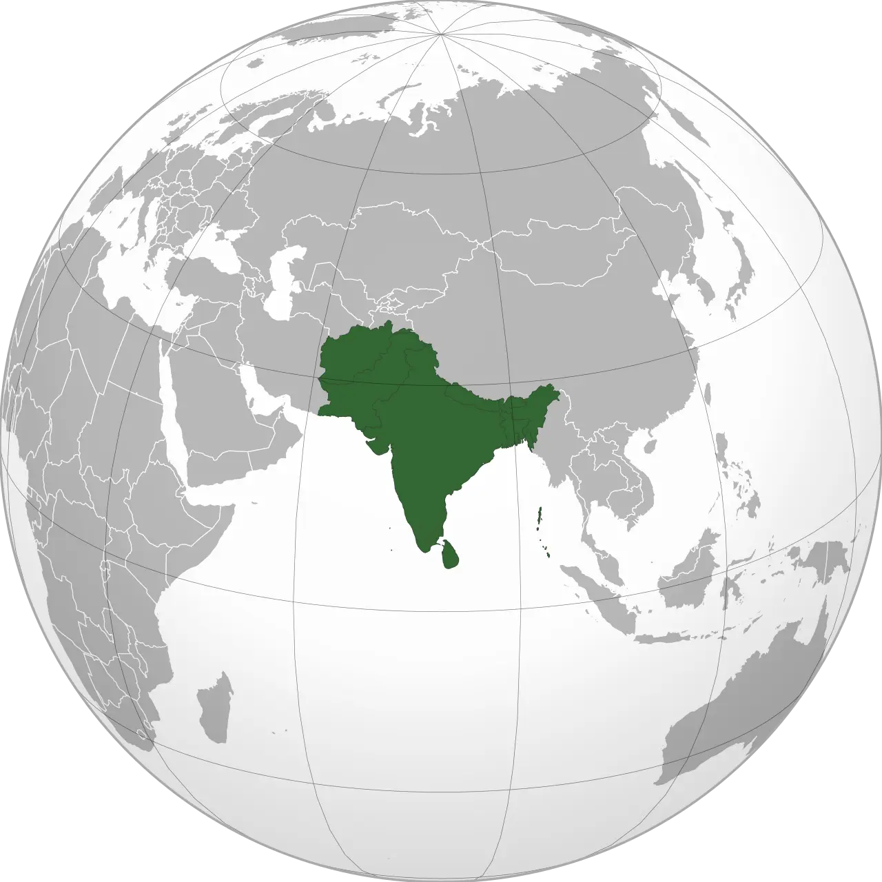
South Asia can loosely be described as the eight nations around the Indian subcontinent, including Afghanistan, Bangladesh, Bhutan, India, Nepal, and Pakistan, as well the island nations of Sri Lanka and the Maldives situated south of India. With a population numbering approximately 1.9 billion, South Asia is the most densely populated geographical region in the world, accounting for 24% of the total human population even though it only occupies approximately 3 percent of the world’s land area.
At this subcontinent’s southern border lies the Indian Ocean, with the Great Himalayas to the northeast and the Hindu Kush mountains to the northwest separating the Indian plate from the rest of continental Asia. To note, the tallest peak in the world, Mount Everest, can be found here in Nepal.
To simplify the region, South Asia can be largely divided into four broadly interconnected climate zones:
The northern Indian edge and Pakistani uplands have a dry subtropical continental climate, the Himalayas have an Alpine climate, the far south of India and southwest Sri Lanka have an equatorial climate, and most of the Indian Peninsula experiences a gradient of tropical climates. The climate in this region is heavily influenced by monsoons, which bring alternating periods of wet and dry weather, with 70%-90% of the region’s precipitation falling during the warm monsoon season.
Located on the western edge of the Pacific Ocean, the countries of China, Japan, Mongolia, North Korea, and South Korea cover a 4.57 million square miles in the region known as East Asia. The temperate climate here is comparable to Europe or North America, with the exception that most rainfall occurs during the warm seasons following the monsoon winds from the south. Within this area lies many climate regions rich in natural resources, from mountains, steppe lands, plateaus, and deserts in the north and west to fertile river valleys and deltas in the southern portions and near the coasts.
Southeast Asia consists of the area east of the Indian subcontinent, south of China, and north of Australia covering 1.73 million square miles of land and another 3.26 million square miles of ocean. Further divided into two subregions, mainland South-East Asia consists of the countries of Cambodia, Thailand, Vietnam, Laos, Myanmar (Burma), part of Malaysia, and the small city-state of Singapore at the southern tip of the Malay Peninsula. South of this point is known as insular south-east Asia, containing Indonesia, the second half of Malaysia, Borneo, Brunei, and the Philippines.
Southeast Asia experiences tropical and subtropical climates with seasonal wet/dry periods. Bordered by the Pacific and Indian oceans, precipitation is received in the form of regularly-occurring monsoons, which follow the shift in direction of the prevailing winds approximately every six months. Due to its position on the Sunda Plate near the intersection of several other tectonic plates, south-east Asia became dominated by a series of mountain ranges, plains and plateaus that form complex drainage systems. To note, this topography tends to create many localized microclimates within the larger environment.
Rice and fish are the traditional food staples in both Southeast and East Asia, with rural agricultural communities continuing to make up a large portion of the population of these countries. The main exception to this population trend would be Japan, which is highly urbanized throughout most of the island-nation.
Africa
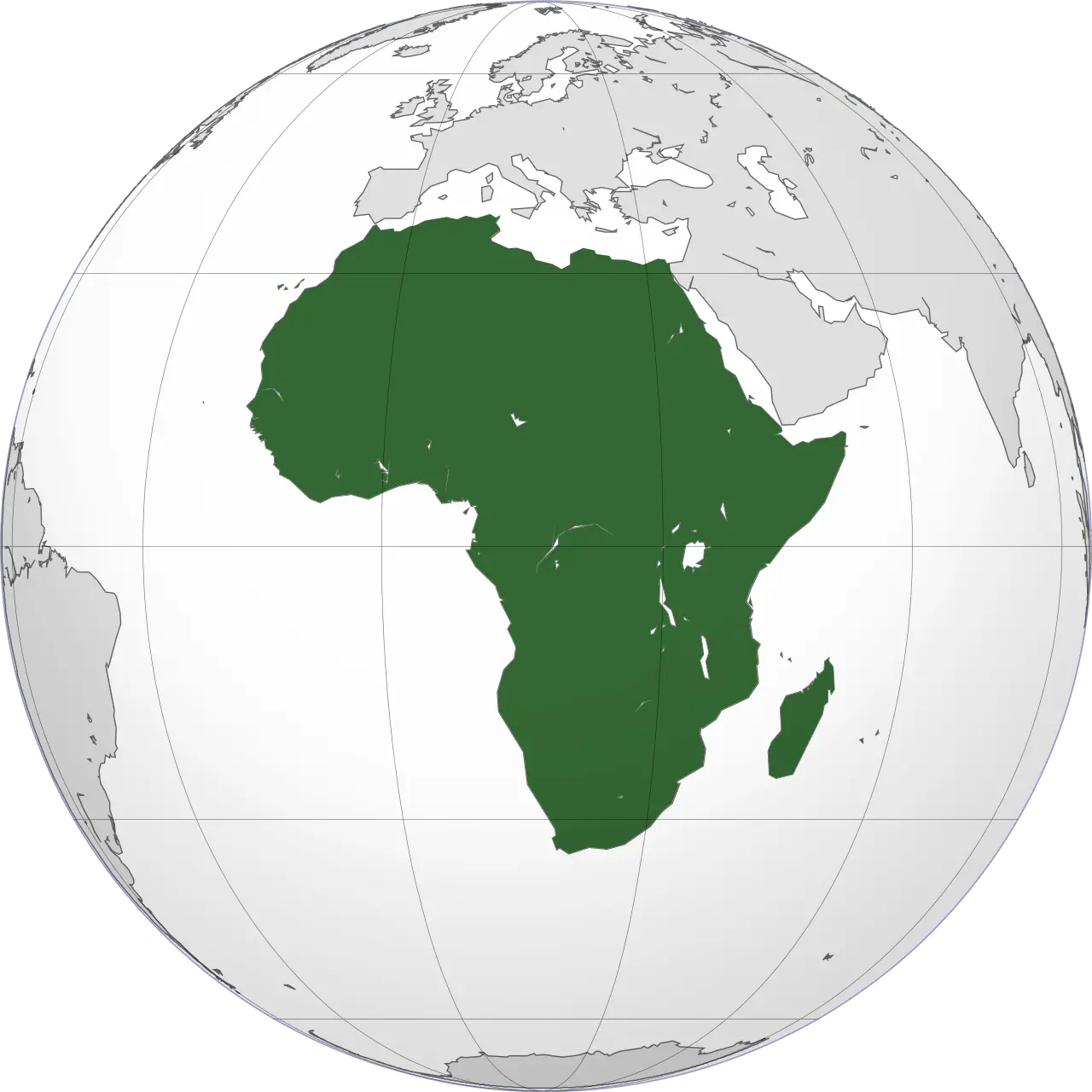
Now let’s move southwest a bit and take a look at Africa. North Africa contains the modern countries of Morocco, Algeria, Tunisia, and Libya, with Egypt and Sudan technically being shared with the South West Asian region. In the present day, North Africa is associated with West Asia in the realm of geopolitics to form a Middle East-North Africa region and is home to roughly 243 million people.
Bordered to the north by the Mediterranean Sea, North Africa has three main geographic features: the Sahara Desert in the south, the Atlas Mountains in the west, and the Nile River and delta in the east. The Sahara is the largest hot desert in the world, covering 75% of the entire region, with sand temperatures reaching 176°F or higher. It serves as the shared boundary of North Africa and the Sub-Saharan Africa, covering a variety of arid regions from volcanoes, mountains, and plateaus to salt flats and sand seas. The Atlas Mountains are part of a resource-rich fold mountain system spanning 1,600 miles into Southern Europe at the northernmost point, but recedes to the south and east, becoming a steppe landscape before meeting the Sahara. This environment is mostly arid, with most fertile areas located along the north and west coastlines of the Atlantic Ocean and the Mediterranean Sea.
On the eastern side of North Africa lies the 4,130-mile long Nile River and associated Nile Delta, which are considered the most fertile growing regions of Northern Africa. Historically supporting the growth of large civilizations, with Ancient Egypt being among the most notable, this watershed crosses the entire Sahara and exits into the Mediterranean Sea in the north. The areas immediately surrounding the Nile River experience seasonal flooding that rejuvenate the soils with silt and natural fertilizers sourced from the lakes and mountains further south in the continent. Climate around the river can be characterized as a humid combination of sub-tropical and Mediterranean depending on latitude, with about 80% average humidity.
Making up the entire southern half of the African continent, Sub-Saharan Africa is home to 14.22% of the world’s population, which comes out to roughly 1.07 billion people. There is a swath of climates present across this region, including desert, semiarid, tropical, and equatorial, each of which contains its own unique plant and animal communities.
Although this southern portion of Africa contains steppes and plateaus, it lacks the extended mountain chains found in the northern part of the continent and most other continental landmasses. To simplify things, Sub-Saharan Africa can be split into seven major physical subregions: the Sahel, the Ethiopian Highlands, the savanna, the Swahili Coast, the rainforest, the African Great Lakes, and Southern Africa.
The south Sahara marks the northern border of Sub-Saharan Africa, which transitions into the semi-arid boundary zone known as the Sahel. This zone stretches across the south-central latitudes of Northern Africa between the Atlantic Ocean and the Red Sea, distinctly separating the Sahara from the Savanna grasslands and demonstrating traits from each.
The Savanna covers about half of Africa, surrounding a portion of the centrally-located Congo rainforest basin. It is bounded by the mountainous north-south running Ethiopian Highlands to the east and the agriculturally depleted sandy Swahili Coast to the southeast. The Atlantic Ocean and Kalahari Desert lie to the west and southwest respectively, with the 2.6-billion-year-old shelf of bedrock known as the “Kaapvaal craton” creating the southern boundary. This shelf is generally known as South Africa and exists as the epicenter of Africa’s well-known endangered animal reserves.
Dispersed among all of these lie the African Great Lakes, which contain a diverse range of microclimates throughout their subregions. These first two subregions cover large bands of the continent, while others such as the Ethiopian Highlands and the Great Lakes are fairly constrained in their area.
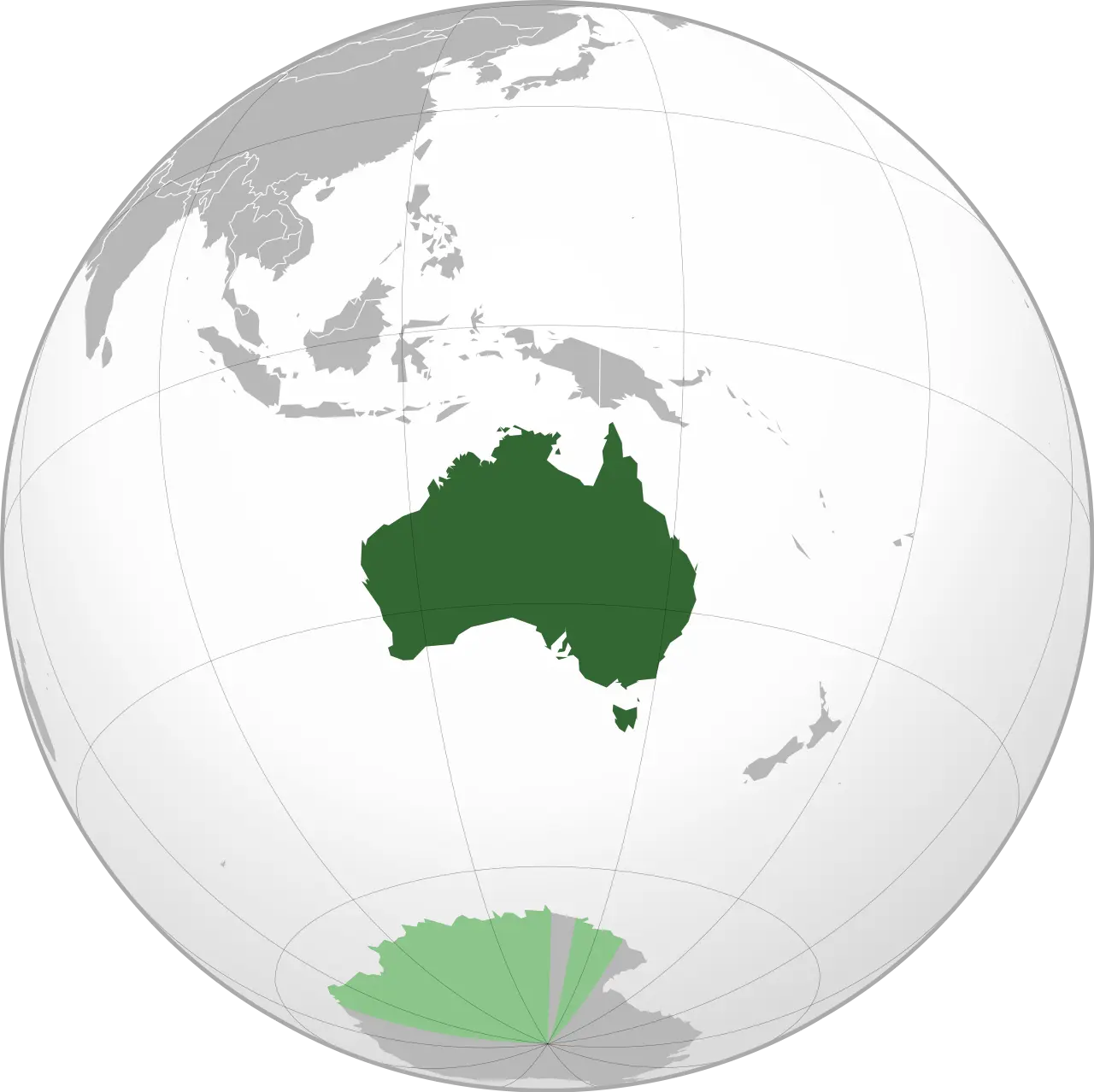
Australia
Finally, let’s look at Australia and Oceania. Oceania refers to some ten thousand islands covering about 317,700 square miles of actual landmass in the South Pacific Ocean, including Papua New Guinea and New Zealand. Many of the islands have large mountains on them as the majority were produced by volcanic activity or uplift from the collision of continental plates, with the tallest peaks located in New Zealand reaching up to 12,000 feet in elevation.
Near the latitude of 23 degrees south, these islands experience tropical climates year-round moderated by the southern Trade Winds. Due to the range of species that thrive in the temperate and tropical rainforests found on the islands throughout this region, it is categorized as one of the world’s largest biodiversity hotspots of both flora and fauna.
Although both Australia and Oceania experience typhoon level storms out of the South Pacific, Oceania historically receives a greater quantity than any other area on the planet. This, in turn, results in a harsh environment for plants, animals, and native peoples among the island chains. Communities affected the most are those who rely on fishing and small-scale farming of cassava, taro, yams, and sweet potatoes for their economies, as well as boats for daily travel or emergency medical care.
In contrast with Oceania, Australia is 2.97 million square miles of landmass located at the center of the Indo-Australian Plate, away from most island-creating processes. Arid desert dominates much of the interior and western side of this continent, with industrial centers being clustered along the coasts and within the eastern “fertile fringe” of the island, where the more humid environment allows for ideal growing conditions to occur. Despite being considered the urban center for this region of the world, there are still many native aboriginal peoples living in the northern half of this continent that maintain a hunter-gatherer way of life on their ancestral lands.
Thanks for watching, and happy studying!